
Metropolitan Planning Organization
859 Willamette St.
Suite 500
Eugene, OR 97401
Ph: 541-682-4405
Fx: 541-682-4099
Email: mpo@lcog.org
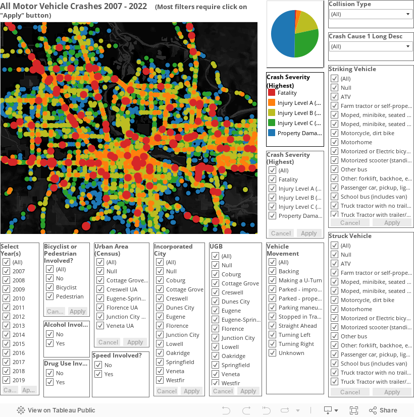
This dashboard is intended to allow the advanced user to explore all of the crash data for Lane County since 2007. The user can filter by year, severity, vehicle type, vehicle movement, driver impairment, and location by city or Urban Area. Note that some of the filters are drop-down, and those, like most of the other filters, allow multiple choices and require the apply button to be clicked in order to change the map. The map by default is centered on the Eugene-Springfield area. If you filter the map to a different geographic area, you will need to pan/zoom with the tools in the upper left corner of the map window. You have to at least "touch" the map or legend in order to download the underlying data using the "download" button at the bottom right. Note that some crashes are "stacked" at the same location, and they will be in the data even if you cannot see them.
Source: Crash data from ODOT. UGB (Urban Growth Boundary) added by LCOG.
Metropolitan Planning Organization
859 Willamette St.
Suite 500
Eugene, OR 97401
Ph: 541-682-4405
Fx: 541-682-4099
Email: mpo@lcog.org