
Metropolitan Planning Organization
859 Willamette St.
Suite 500
Eugene, OR 97401
Ph: 541-682-4405
Fx: 541-682-4099
Email: mpo@lcog.org
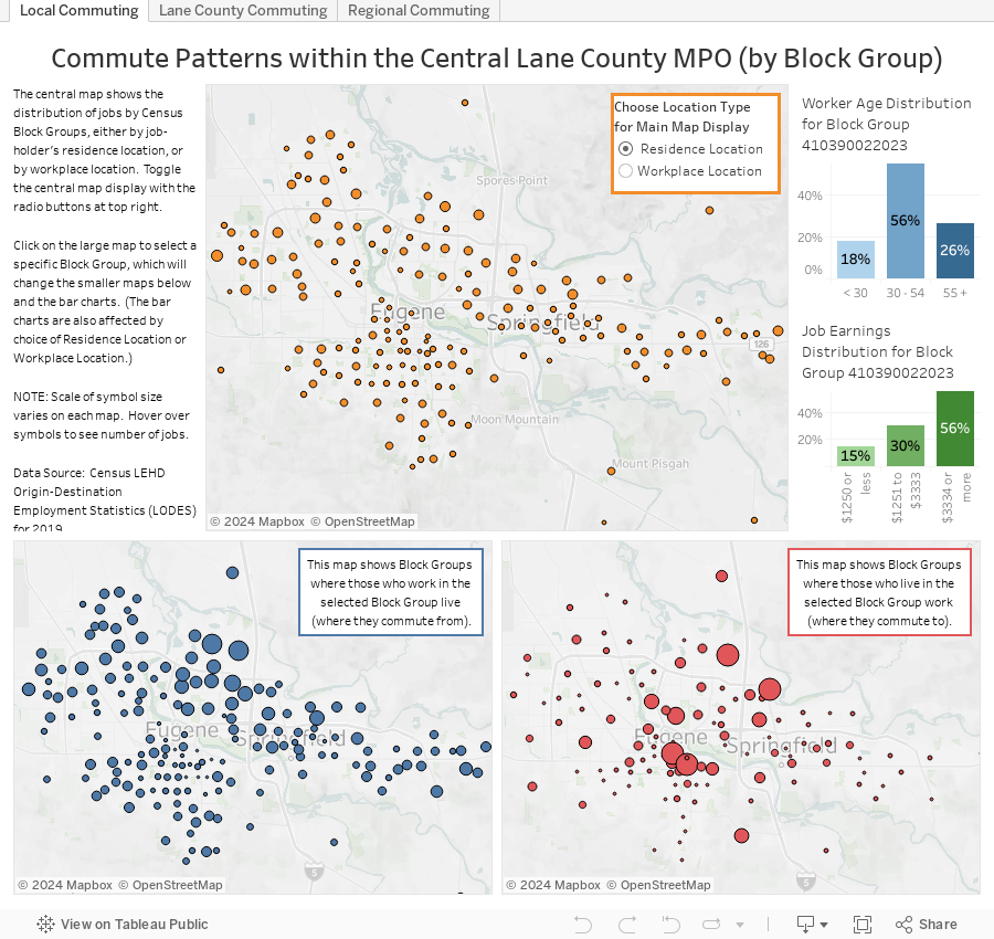
The interactive maps below provide information about commuting patterns. The maps on the first tab show local commuting patterns within the Central Lane MPO Area (by Census Block Group). The maps on the second tab show commuting patterns around Lane County and the surrounding vicinity. The maps on the third tab show larger regional commuting patterns among the cities up and down the Interstate-5 corridor from Salem to Roseburg.
On all three tabs, the first map shows the overall distribution of jobs and workers, and that map can be toggled to show distribution by workplace location or distribution by workers' residence location. Clicking on the first map will select a specific location (either a Block Group or a city), and will change the other two maps to show the distribution of workers commuting to and commuting from that selected location. Hover over maps to see details. Accompanying bar charts show breakdowns of workers and jobs by age and earnings.
Source: LEHD Origin-Destination Employment Statistics (LODES) data for Oregon for 2019. LODES data are part of the Local Employment Household Dynamics (LEHD) program, which is a partnership between the US Census Bureau and the states. The LODES data are partially synthetic in order to conceal specific individual commutes.
Metropolitan Planning Organization
859 Willamette St.
Suite 500
Eugene, OR 97401
Ph: 541-682-4405
Fx: 541-682-4099
Email: mpo@lcog.org